Monday, May 30, 2005
daylily
Saturday, May 21, 2005
guitar
Wednesday, May 18, 2005
frugal living --- with james
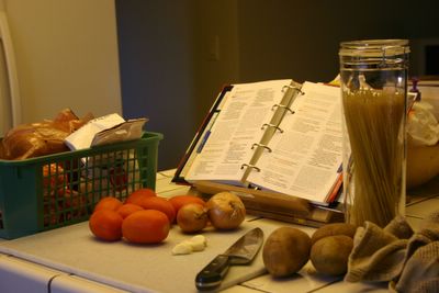
So we're doing our own cooking again at home. Maila requested a dish for dinner that I haven't done in a while -- pasta with fresh tomato and basil sauce. I like it because I love the flavor of the tomatoes sweetened by the simmering process, along the with sweetness of the basil. And when serving, I use enough sauce just to coat the pasta.
It's very basic, not too many ingredients, and I like to pair it with chicken breast or steamed seafood of some sort.
------------------------
Start with 4 cups fresh tomatoes, chopped and seeded, 1/4 cup onion, 3 cloves of garlic, salt, pepper and about 2 tsp basil (dried).
- Saute the onions and garlic until tender, but not brown.
- Add the tomatoes and the salt and pepper.
- Bring to a boil, then simmer for about 40 minutes. After the 40 minutes, add the basil and simmer 5 minutes more, then you're done with the sauce.
- While the sauce is simmering, start preparing the pasta. This sauce works well with either spaghetti or capellini.
- While the pasta is cooking, start preparing the chicken. I use a simple marinade of olive oil, salt, pepper and rosemary, and set it aside for about 15 minutes. The chicken can be grilled or fried.
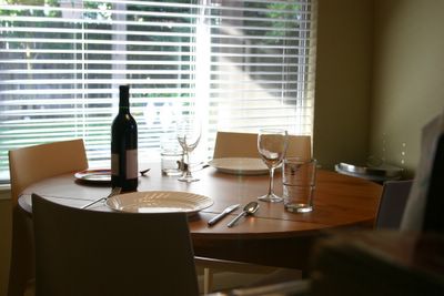
- While all that is cooking, wash your used utensils (I learned from my sister, that this is the only way to keep ahead of all the dishwashing later), and take the opportunity to set the table.

- But it's only a matter of time before the little hurricane discovers what you're doing and starts to play musical instruments with the stemware.
- So forget about the candles, and put aside the breakables. It's time to take out what's really for dinner.
Friday, May 13, 2005
locke, ca
TODAY IS MY DAY OFF, and Maila was at work. I decided to take the daughter and visit my brother in Stockton (and borrow his beautiful DeWalt miter saw while I was there).
But for some time I've been meaning also to visit the picturesque little town of Locke. So, I took the opportunity to pass by along the way.
Described as America’s last rural Chinese town, it was constructed in the early 1900s by Chinese immigrants in the Walnut Grove area who decided to establish their own town.
Today, its main street is lined with small art shops, a museum, and some eateries.
Locke, CA is located about 30 miles south of Sacramento. I was glad to have visited the town, and my only regret is that it was early when I was there and I wasn’t able to talk to anyone. I would like to return someday, on a weekend, to see what it’s like with people around.
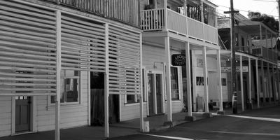
Some of the shops along the street.

The River Road Gallery.

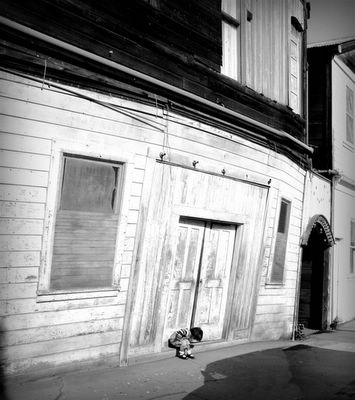
The Star Theatre Building: if this building seems to be leaning, that’s because it is. It may be easier to visualize when compared to the building on the right side of the photo.
 In spite of the age of the town, there is a bit of playful, updated color around. The balconies above the shops overlook the main street, and apparently are still in use.

A final shot of the main street.
But for some time I've been meaning also to visit the picturesque little town of Locke. So, I took the opportunity to pass by along the way.
Described as America’s last rural Chinese town, it was constructed in the early 1900s by Chinese immigrants in the Walnut Grove area who decided to establish their own town.
Today, its main street is lined with small art shops, a museum, and some eateries.
Locke, CA is located about 30 miles south of Sacramento. I was glad to have visited the town, and my only regret is that it was early when I was there and I wasn’t able to talk to anyone. I would like to return someday, on a weekend, to see what it’s like with people around.
---------------------------

Some of the shops along the street.

The River Road Gallery.


The Star Theatre Building: if this building seems to be leaning, that’s because it is. It may be easier to visualize when compared to the building on the right side of the photo.
 In spite of the age of the town, there is a bit of playful, updated color around. The balconies above the shops overlook the main street, and apparently are still in use.
A final shot of the main street.
Friday, May 06, 2005
fun with lomo


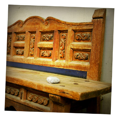

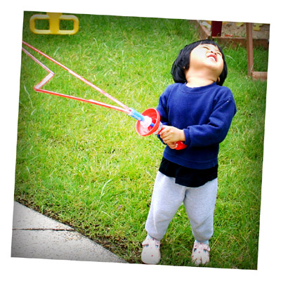
Okay, so this is not true lomography -- I just post-processed these to simulate the 'lomo' effect.
Lomography was kind of interesting to me, until I started learning more about it, and I started to notice the differences between lomo and conventional photography.
Still, there's something appealing about the raw feeling one senses with Lomo's carefree nature, and it's results.
Hey... if nothing else, it seems to be a great way to recycle my old 'rejects'. ;)
Wednesday, May 04, 2005
cold canyon hike
Nothing beats the feeling of walking along peaceful surroundings, where all you can hear is a creek running on your left, and, at times, the sound of your own heartbeat.
My buddy James W and I took half the day off yesterday to hike the trail in Cold Canyon, just north of the town of Winters.
And what a hike it was.
There is much to tell about the history of the trail, but I'll forego that in the interest of being brief.
By the end of the day I had amassed 174 pictures. I suspect James shot about the same.
So while there was much more to tell about the trip than is shown here (ie, encounters with poison oak, being interviewed by a local reporter, etc.), I hope that I can communicate in a general sense what it was like.
--------------------------------
 The route is a loop that takes you on a steady climb south along the Homestead Trail, then turns quite steep as you reach the southern portion of the loop. As you make the u-turn to go north, you eventually reach the ridgeline along the Blue Ridge Loop Trail.
 There were many opportunities along the Homestead Trail to view the creeks. And I love to shoot these small waterfalls.
 Standing at the southern portion of the trail, we could see the town below (near the center of the photo) and Highway 128, where we came from. Towards the west is the Blue Ridge Loop trail, along which we hiked.
(This panorama is about 5 photos stitched together.)
 As we eventually reached the ridgeline, I took the opportunity to take a picture of James to give a sense of scale. The elevation gain to the top of this peak is about 1500 feet - quite a climb.
 Many interesting sights along the way, including local wildlife and the flowers. Considering the weather is starting to heat up, we were surprised by the amount of color there was along the way.
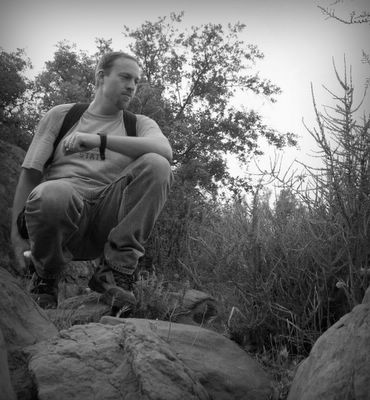 hiking buddy James W
 Along the ridgeline, we found ourselves higher than where the local birds flew. This, I believe, is one of the turkey vultures. My other (blurry) shots show their red heads.
 Looking west we found our reward - a stunning view of Lake Berryessa.
 The climb was tortuous.
At least it was for me.
 It's always a good idea to watch out for poisonous rattle snakes, such as this one I found resting next to my leg.
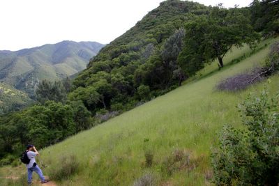 On the way down now. I just wanted to show how steep the walk down was. It gave our ankles quite a workout. I was feeling it!
 I decided to share a shot of my gear. By the time we got back to the car my body was beat, but I was happy about the whole trip.
 The route is a loop that takes you on a steady climb south along the Homestead Trail, then turns quite steep as you reach the southern portion of the loop. As you make the u-turn to go north, you eventually reach the ridgeline along the Blue Ridge Loop Trail.
 There were many opportunities along the Homestead Trail to view the creeks. And I love to shoot these small waterfalls.
 Standing at the southern portion of the trail, we could see the town below (near the center of the photo) and Highway 128, where we came from. Towards the west is the Blue Ridge Loop trail, along which we hiked.
(This panorama is about 5 photos stitched together.)
 As we eventually reached the ridgeline, I took the opportunity to take a picture of James to give a sense of scale. The elevation gain to the top of this peak is about 1500 feet - quite a climb.
 Many interesting sights along the way, including local wildlife and the flowers. Considering the weather is starting to heat up, we were surprised by the amount of color there was along the way.
 hiking buddy James W
 Along the ridgeline, we found ourselves higher than where the local birds flew. This, I believe, is one of the turkey vultures. My other (blurry) shots show their red heads.
 Looking west we found our reward - a stunning view of Lake Berryessa.
 The climb was tortuous.
 At least it was for me.
 It's always a good idea to watch out for poisonous rattle snakes, such as this one I found resting next to my leg.
 On the way down now. I just wanted to show how steep the walk down was. It gave our ankles quite a workout. I was feeling it!
 I decided to share a shot of my gear. By the time we got back to the car my body was beat, but I was happy about the whole trip.
Subscribe to Comments [Atom]

